Please read the lesson material below and answer the questions for the lesson. Don't forget to include your contact information so we can review your answers and respond to your comments or questions. If you make at least 60%, you should continue onto the next lesson. Otherwise, please review the material and try again. You need to average at least 70% to pass the course. We will contact you via email within a few days of receiving your answers.
Bible Geography II
Jericho, Qumran, and the Dead Sea
.jpg)
Jerusalem is 2700 feet above sea level and Jericho is 800 feet below sea level. It was in this area that King Herod built a great palace. It is warm in the winter months, and people from Jerusalem very often come to Jericho as a resort town. It is thought that many of the priests lived here during Jesus’ time.
.jpg)
You will recall that Luke indicated in his gospel that there were 12 courses of the priests. Zacharias was one of these, and his time had come to serve in the temple at Jerusalem. Not all of them could serve at the same time, so they were divided into groups and perhaps served only a few times in their lives. Jesus’ parable of the Good Samaritan indicates to us that that the priest and the Levite were traveling from Jericho to Jerusalem.
.jpg)
This is the top of the Tell or mound. The Arab word "Tell" means "hill containing a man-made ruin" as opposed to a natural hill or formation. This is called the "Tell es-Sultan". The ruin covers 7.8 acres. Jericho was a walled city at times and is considered the world’s oldest city.
.jpg)
In the distance is a refugee camp. 25,000 Palestinians were located here when the State of Israel was created by the United Nations in 1948. This is a troubled spot. Those Palestinians were moved from the lands they and their parents owned and occupied for many, many years. There is great bitterness in their hearts against the Israelis for taking their land. The refugee camp is not occupied now. Since the Six Day War in 1967, the Palestinians moved back across the Jordan and are living in Jordan today.
.jpg)
This mound was here in the time of Jesus. It had not been excavated then, and no city had been built upon it. Jericho of the New Testament is about 1 ½ miles west from here. I wonder if Jesus saw it; I rather imagine he did. The mound is 1200 feet long, and is 50 feet high. In Old Testament times Jericho was called the "City of the Palm Trees". There are two references in the Old Testament that use this description: Deuteronomy 34:3 and 2 Chronicles 28:15.
.jpg)
We are looking now to the left of the mound, and as we are facing south, this would be the eastern side of the mound. The spring that supplied water for this ancient city is here. It is called "Elisha’s Spring". 2 Kings 2:19 tells us that the waters were bitter and that Elisha performed a miracle upon this spring by pouring salt into it to sweeten it.
.jpg)
Elisha and Elijah were here on numerous occasions. The school for the prophets, called "The Sons of the Prophets", was located here. It is mentioned in 2 Kings 2.
.jpg)
Here is a closer look at Elijah’s Spring. Two things were needed for ancient cities: water and fortification. They were usually built on a high place and were surrounded by a wall, so they could be defended from their enemies. Water was necessary for their existence. One of the problems the people faced was getting water inside their cities, especially during times of siege. This was what Hezekiah did when the Assyrian general Sennacherib besieged the city of Jerusalem. This stream still supplies much of the water for Jericho.
This mound is uneven on top. There are four smaller mounds on it, and the highest is 90 feet. This is 40 feet above the level of the lower mound.
.jpg)
We are looking now from the Tell, and this gives you some idea of the height. The climate is semitropical. Oranges, lemons and other citrus fruits grow in abundance here. Bananas are even grown in this area. Many vegetables come from Jericho. In fact, it is the center of produce for Jerusalem. In ancient times it dominated the trade for salt. Because of its proximity to the Dead Sea, we can see why salt was so plentiful here.
.jpg)
We are looking toward the north end of the mound. Charles Warren was the first to excavate or at lease to sink an exploratory shaft on this mound. This first shaft was dug in 1867. He discounted it as the ruins of Jericho. Ernest Sellin and C. Watzinger, two German archaeologists, extended the excavations in 1907 and 1908. However, one of the most famous excavators of this mound was John Garstang. His excavations spanned the years from 1930-1936. He found several layers of occupation. He labeled what he called City Four as the city that was destroyed by Joshua. He fixed the date between 1400 and 1385 BC. However, his findings have been disputed by Kathleen Kenyon, a British archaeologist and the daughter of Sir Frederick Kenyon. She excavated from 1952 to 1958. She is still publishing her findings, and these dispute the claims of Garstang.
.jpg)
Here is one of several shafts or pits. Kenyon, in differing with the findings of Garstang, noted that there were 17 rebuilding phases. The evidence for them is found on the west side, where there is evidence of many walls, some of stone and some of man-made, sun dried bricks.
.jpg)
This shaft gives us an idea of one of the methods used in excavating a tell or mound. Think of it as a large cake. The archaeologist will take a slice from this cake. He will look at the slice and note the levels the objects in it occupy. The lower the level in the slice, the farther back in time the objects are. He will classify the weapons, tools, pottery and bones of the people who were buried in this tell. All of these together will give him some idea of the type of people who lived during the various times.
.jpg)
This shaft shows you the depth of the dig. Kenyon says that this was an original tower of defense, dating as far back as 7000 BC. The wall, made of stone, is 12 feet high. It was probably 23 feet high originally.
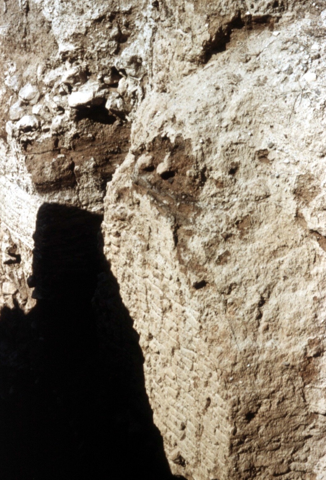
This shaft shows us the next phase in excavating. Kenyon found some rectangular houses. The floors were of plaster with a glossy finish and were highly polished. In many of these houses, the dead were buried beneath the floors. It might indicate some kind of ancestor worship she says. Several hundred graves have been found in this area.
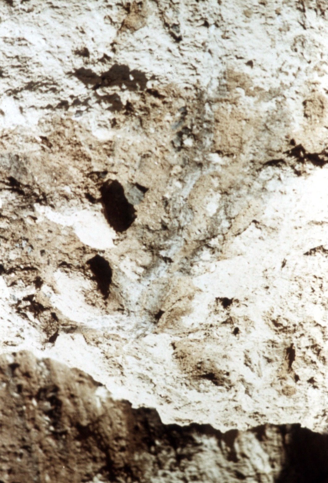
The dark line running through this picture is an ash line. Not only did Joshua cause the walls of the city to fall down but the Bible says that he burned the city with fire. Guides will point out this level of occupation as the Joshua city, but no archaeologist will confirm this.
.jpg)
This ash line continues in another area. There is evidence of several great earthquakes, were buildings were cracked, and the destruction would indicate that it was not warfare but an earthquake that had separated the building from its foundation.
.jpg)
Kenyon found in several of the ruins indications of the Hyksos Period. This was a time when Egypt was occupied by Shepherd kings, from 1750 to 1550 BC. This would have been the time that Joseph went down into Egypt. It was the time of the Patriarchs, and Joseph’s father, Jacob would have still been in the land of Canaan. This is the only period in the excavations where food deposits have been found. Roasted sheep, trays of pomegranates, and ostrich eggs were found in some of the graves. Kenyon found nothing from the period of 1400 to 1300 BC.
.jpg)
This is the Tower Pit is the oldest find of the excavation. Kathleen Kenyon excavated this pit. It dates back to the Neolithic Period (10,000-8,000 BC). No one knows why it was not destroyed in the time of Joshua. Many different levels of civilization have been found, and we do not know which one is from the time of Joshua.
.jpg)
We are looking at the bottom of the Neolithic tower. You can see a door. This was a free standing tower, or, in other words, no mortar (cement) was used in it. Was it used for worship or was it a tower of defense? Archaeologists have never determined its use. But it is among the oldest of the ruins to be found in this tell.
.jpg)
These steps are a reconstruction. They lead to the tower on our left. An entrance is at the top, and there are steps that wind down through it to the bottom.
.jpg)
You can see how deep this dig is. This pit is 40 to 45 feet deep. Compare it with the size of the people standing here. The tower goes down another 30 feet from the steps you see.
.jpg)
We take one last look as we leave the mound. When Garstang fixed the date of the level he labeled as Joshua’s city at 1400 to 1385 BC, he was trying to justify 1 Kings 6:1 with his findings. This passage states that Solomon began building the temple in the city of Jerusalem 480 years after the Exodus. There has been much erosion of this mound. Garstang was honest in his efforts to find the city that should have been dated 1400 BC., which would have been the time, according to his reckoning, that the Children of Israel would have come into the land of Canaan under the leadership of Joshua. Actually, there is no evidence to prove that the walls fell outwardly. We believe it because the Bible says that it was so. There is no evidence for the city which Joshua burned. There is evidence of ash in several different layers, and one of these could be Joshua’s Jericho, but we cannot prove it. We should not be disappointed in archaeology because we cannot prove from this particular excavation that Joshua destroyed the city. We believe it because God’s Word says it is so.
.jpg)
The Dead Sea is quite beautiful, although we know that there is nothing living in it. We are looking across from the north. It is near Jericho, and the Sea of Galilee is 65 miles north. The Jordan River connects the Sea of Galilee with the Dead Sea. The Dead Sea is 47 miles long and 10 miles wide. It is 1278 feet deep and is 1292 feet below sea level, so it is the lowest point on earth. The Dead Sea is 27% in mineral content. It contains not only salt but potash, bromide, gypsum, calcium and magnesium. It is said that seven million tons of water evaporate from this sea each day.
.jpg)
Bathers come here from all over the word. It is impossible to sink in these waters. This would be a good place to learn to float, but any scratch or wounds would certainly sting in this salt water.
.jpg)
The people are covering their bodies with mud from the bottom of the Dead Sea. They believe it has healing qualities. There is some truth to this belief, because this mud is high in mineral content, and the salt water and warm climate probably all contribute to good health in one form or another.
.jpg)
We have moved to a midway point on the western side of the Dead Sea. We have come to a famous spot. "En-gedi", literally, the "Spring of the Kid. This is an oasis. There is a large foundation here and there is a rocky beach for swimming.
.jpg)
The Dead Sea covers 370 square miles. It is much larger than the Sea of Galilee.
.jpg)
En-gedi is 10 miles south of the Great Fortress of Masada. It was here that David took refuge when he was fleeing from King Saul. It was in one of these caves that Saul went to sleep. David went into the cave and cut off the portion of Saul’s garment. This was to show Saul that David had spared his life.
.jpg)
This is Masada. Herod the Great built this fortress. He was a mad man and a terrified one. He wanted to make sure his enemies could not kill him. This fortress is about 1300 feet high. When the city of Jerusalem fell in 70 AD, a group of Jewish Zealots led by Eleazar ben Yair came to this fortress and took it from the Romans. For about 3 years 960 of them held out at the top of this mountain, while the whole Roman army, under the generalship of Flavius Silva, tried to take the fortress back. The Romans finally built a ramp all the way to the top to find that these Zealots had all killed themselves rather than be taken captives by the Romans. Only 2 women and 5 children were left. The story is told by Josephus.
.jpg)
This is what Herod could have seen from the top of his fortress, a magnificent view. We are looking north toward Jerusalem, and this is the direction that the enemies Herod so feared would have come from. He died probably in 4 AD.
.jpg)
At the northwest corner of the Dead Sea we find some of the most interesting ruins in all the Bible world. This is Khirbat Qumran. "Khirbat" means "ruins", and "Qumran" means "settlement". It was the village of the Essenes, a sect of the Jews. It is 26 miles from Jerusalem and Bethlehem. It is due east of Bethlehem. A fortress has been built here. The Essenes sought to escape the routine of daily life and escape to a place where they could live a righteous and holy life.
.jpg)
This cistern is one of seven. Water was a precious commodity in this land. This sect of the Jews was stricter than the Pharisees. Josephus made a reference to this fact. The Jews in the time of Jesus were divided into sects of Pharisees, Sadducees, Essenes, and Herodians. Of these sects, the Essenes were the strictest.
.jpg)
This is a panoramic view of the ruins. We are looking at what was probably the fortress. It was not well fortified and did not really protect them. The Essenes were overrun and probably destroyed in 70 AD when the Romans armies came to this area also. The Essenes believed in predestination. A candidate for admission into the community was carefully watched for the 2 years that he served as a novice. He was to display signs of grace from God, so it would be know whether God wanted him to be a member. If he was admitted, he had to give up his property and his money to the community itself. This community would meet at dawn for prayers. They worked until 11 AM and then gathered back here to put on white robes and be bathed in cold water. Their rite of baptism was a daily cleansing. They ate their meal together. They had a prayer before and after the meal. They ate mostly in silence, but on some occasions the scriptures would be read during the meal. They went to work again until evening, when they returned for another meal.
.jpg)
This is probably the council room. This ruin was excavated in 1951 by Pierre DeVaux of Jerusalem and G. Lanchester Harding, a British who was working with the Palestine Museum of Archaeology. The finding of a number of scrolls led to the excavation of this ruin. The scrolls are referred to as the Dead Sea Scrolls. Many, many books have been written about these scrolls. We are interested in them because all of the Old Testament books with the exception of Esther are represented in these scrolls. Two of the most famous are the two complete copies of the book of Isaiah. All of these scrolls are approximately 1,000 years older than any of the manuscripts of the Old Testament we had in our possession. So you can see what a significant find this was.
.jpg)
This could have been the dining hall. Many of these rooms are separated by court rooms. There was a large kitchen in connection with the dining hall.
.jpg)
From our same view point we look toward the sea. Between here and the sea is a graveyard where 1,000 graves have been discovered. While very little mention is made of the women in the writings of the Essenses, we now know that women lived there. Bones of women were found in the graveyard. The word “khirbet” is the Arab word for "ruins", so the Khirbet Qumran is the "ruin of Qumran". These ruins cover an area 128 yards long by 80 yards wide.
.jpg)
Now to our right we find the entrance of the aqueduct. There is a settling basin here where water is channeled from rains that come in the mountain areas. The rains flowed down this aquaduct and came into the ruins. These large cisterns or pools would be filled with water after it had settled in the first basin and cleared.
.jpg)
This is probably the council room. The dining hall is in the adjacent part. The council hall is where the Essenes met for their discussions of the Scriptures. In each group of ten there always had to be at least one man studying or interpreting the Scriptures of the law. Membership was divided into 3 different shifts, to keep the reading of the law going even through the night. Interrupting one’s neighbor in a public session meant 10 days in isolation. Leaving the council hall of the Assembly of the Many “aimlessly or wantonly” as many as 3 times during the session, meant 10 to 30 days confinement. Spitting on the floor meant 30 days in isolation. One indulging in foolish laughter also meant 30 days in isolation. Indecent talk resulted in 3 months in isolation. So there were some strict rules, and the council room and the dining hall would be two of the places they would be enforced.
.jpg)
Here is some clear evidence of the water channel. This channel threads its way throughout the ruins. As I mentioned before, when the rains came these channels were used to bring water to the large cisterns scattered throughout the ruins.
.jpg)
This is a good example of the cisterns. You can see that this would hold several thousands of gallons of water. There are several of these. Two of them probably were used for baptizing.
.jpg)
This is the storeroom for pottery. We have evidenced that there was a kiln for firing pottery, and a pottery making room. Some of the Biblical scrolls and some sect scrolls were stored in large pottery jars that were probably made in this very area.
.jpg)
Here is a view of the mountain to the west of the ruins. Rains do come into this area, but not often. I mentioned that Jericho gets an average of 4 inches of rain. This area would probably get the same. The rains usually come in December, January and February. The waters coming from these mountains gush down. The water channel was placed in a strategic location to catch as much water as possible and to funnel it down to the community. During the dry season fresh water could be obtained a mile and a half away at a spring called "Ain Feshkha".
.jpg)
The Wadi Qumran is this deep valley that separates where we are standing, from those mountains where the rains would come. "Wadi" is the Arab word for a "dry stream bed". It would flow only in times of the spring or winter rains. New Mexico has the same type of thing which is called an "Arroyo". An arroyo is not a creek or river, but a dry bed that flows only when the mountains catch a lot of water.
.jpg)
This wadi separates us from the caves you see in the center of our picture. The terrain here is very rough. These limestone deposits have been washed away leaving sandstone, so the ground is very porous. When the water washes away the stone carves some interesting formations. This is the west side of the ruin Qumran.
.jpg)
These two caves are number 4 and 5. A number of our biblical manuscripts were found in these very caves. In cave number 4 was one of the richest finds of all. Of the many caves that were explored, caves 1, 4, and 11 have yielded some of our finest biblical manuscripts.
.jpg)
You can see by the rugged terrain, how difficult it would be to excavate or even enter these caves when they were first found. The story is certainly an interesting one. An Arab shepherd boy threw a rock into cave 1, thinking that one of his sheep had been lost in the cave. He heard a sound of the breaking of jars. He got his brother and later went in to investigate. He found there some old scrolls stored in pottery jars. He took them in to an antiquities dealer. The scrolls passed through several hands. Some of them went to an archaeologist at the University of Jerusalem. Others went to the Syrian Orthodox Church. These were taken to the American School of Oriental Research in the city of Jerusalem. Four of the scrolls came to America and were ultimately sold to Yigael Yadin, who took them back to Jerusalem. Now all the scrolls are in the Shrine of the Scroll in the city of Jerusalem. The first scrolls were found in 1947. News of them reached the Biblical world in 1948. Since that time more than 400 of the caves in this area have been excavated and 1,000 caves have been inspected.
.jpg)
We are looking from the road up at the caves. You can see in the center of the picture caves 4 and 5. The ruin of Qumran is on the upper right and toward the back.
.jpg)
Another cistern is here. I mentioned earlier that baptism was a part of their daily ritual. Some have tried to associate John the Baptist with the Essenes. This was the thesis of several who wrote books on the Dead Sea Scrolls when they were first found. It has never been successfully proven. In fact, there are too many differences between John and the Essenes. Just because they baptized does not mean that John had taken his doctrine from them.
.jpg)
Now we are on the eastern side, and here we see another one of the large cisterns. Water was such a precious commodity; we can easily see why so many cisterns were dug.
.jpg)
This is believed to be another of the baptizing pools. When DeVaux was asked about the baptismal pools, he said that the finest of these seven pools was used for the baptizing.
.jpg)
This may be the pottery making area. There were many rooms for different activities. All of the people did not live right here in the community. Some of them occupied caves. The excavations show that they lived in the caves and worked around this area with the sheep and the animals they kept.
.jpg)
These steps have been reconstructed, and the raised part would indicate a split in the original steps. It is thought that this split was made by an earthquake. Josephus tells of a great earthquake in Judea about 31 BC. The Essenes probably occupied this site as early as 200 BC. Perhaps they fled this place because of the earthquake.
.jpg)
This council chamber is one of the largest rooms. It would have been their general meeting room. One of the scrolls found was called the "Manual of Discipline". It sets down the rules by which this sect of the Jews were governed. It contained a great deal about their life and their way of working. There was a commentary on the Book of Habakkuk, and another called the "Genesis Apocryphon". It was first known as the "Lamech Scrol"l. It contains apocryphal accounts in Arabic about some of the patriarchs in Genesis, such as Noah, Abraham, and Lamech. Two complete scrolls of Isaiah were found. The finer of these two is 24 feet long, and it is almost identical to our book of Isaiah. It is sometimes called the" St. Mark’s Monastery Isaiah Scroll". One was called "The War Scroll" in which the sons of light were given instructions for warfare against their enemies, the sons of darkness. One called the "Thanksgiving Hymns" contains 30 hymns resembling some of the Old Testament Psalms. An apocryphal psalm was found, called "Psalm 151". Every book of the Old Testament except Esther is mentioned in the Dead Sea Scrolls. There are 13 representations of Deuteronomy, 12 of Isaiah, a number of Minor Prophets, 10 different sections concerning the Psalms. Daniel must have been read a great deal, because 2 copies of Daniel were found in cave #1, 4 copies in cave #4, and 1 copy in cave #6. Some commentaries on some of the Biblical books were found. A verse by verse interpretation was done. The Essenes would say, “The explanation of this is,” and then they would give the explanation.
.jpg)
I have saved the most important room for the last. This is the Scriptorium. This is where the Essenes would have copied these various manuscripts of our Old Testament. This room is 43 feet long by 13 feet wide. The excavators found a bench, a long, narrow table, and there were even ink pots with dried ink. This was the greatest Biblical manuscript find of modern times. It pushed the actual manuscripts of our Old Testament back by a thousand years earlier than the manuscripts our Bible had been translated from. We now have looked at Jericho, the Dead Sea, and Qumran. This is certainly one of the most interesting sections of the Bible lands.
Original text and slides from "Bible Cities and Geography", ©1974 Star Bible Publications. Unlawful to duplicate or reproduce in any form or manner. Used by permission. Various edits and new audio recordings by the Bible Study Center 2006-2014.
Our Office:
The Bible Study Center
C. C. Regis Building
N. Bacalso Avenue, Corner Eucalyptus
Basak San Nicholas
6000 Cebu City, Philippines
(Get directions/map)
Cell:
0956-627-8606
Landline:
(+63) (32) 414-6311
Office Hours:
Monday through Friday:
1:00 PM - 7:00 PM